Images of the agreed area
Aerial thermal images showing the surface-temperature patterns captured during the visit, subject to suitable conditions.


Open Sky Photography · Edinburgh, East Lothian & Scotland
See surface-temperature patterns alongside detailed visual images. Our thermal drone surveys help you identify areas that deserve investigation, from building envelopes and roofs to solar arrays and agreed search areas.
Commercial solar PV
Combine thermal imaging with visual inspection to identify unusual patterns across a commercial rooftop or ground-mounted array. Agree coverage, capture conditions and location references so your contractor can find the relevant area and decide which checks are needed.
View commercial solar inspection options, our own footage and an example annotated observation →
Renew-Able’s commercial maintenance case study explains how aerial imagery complements inverter monitoring and on-site electrical checks. A thermal pattern alone does not establish a fault or certify safety.
DJI thermal imagery in practice
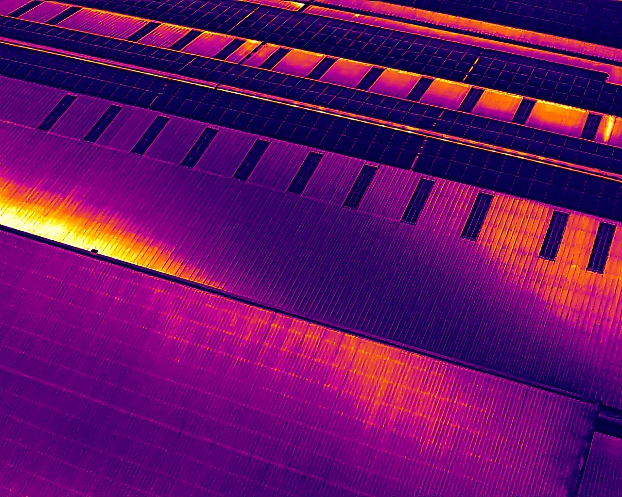
This DJI thermal photograph from a commercial rooftop solar inspection shows how panels and roof materials appear in the thermal view. We use imagery like this alongside visual photographs to locate areas that warrant closer investigation.
Colours alone do not establish a fault: materials, reflections and conditions all affect the image.
Two views of the same subject
The infrared camera highlights differences in heat emitted from visible surfaces. A visual camera then helps locate that pattern on the roof, wall, panel or surrounding landscape.
We use the Matrice 400 with H30T, and our Matrice 4T and 4TD options, to plan capture around the site. The aim is useful evidence for your next decision: a closer inspection, maintenance visit or coordinated ground check.
For solar arrays, see our combined infrared and HD inspection →

What you get
We agree the inspected areas, reporting level and image outputs in your quotation.
Aerial thermal images showing the surface-temperature patterns captured during the visit, subject to suitable conditions.
Visible-light views to help you identify the building feature or asset shown in the thermal image.
Selected images of unusual patterns, with annotations or a location plan where commissioned. These help direct the next inspection.
An explanation of what the imagery shows and the relevant capture limitations. Written reports and specialist interpretation are agreed before the visit.
See the equipment in action
DJI’s H30-series introduction illustrates the imaging technology behind this service. Thermal capability is provided by the H30T model.
The demonstration includes applications and operating conditions beyond an individual building survey. Your quotation defines the work we will carry out.
More on the technique: DJI’s thermal imaging guide.
Manufacturer demonstration from DJI. This is illustrative footage, not an Open Sky customer survey. Open the DJI demonstration →
Buildings and assets
Sunshine, wind, rain, reflections, surface materials and the difference between inside and outside temperatures can affect the result. A building heat-loss survey and an operating solar-array inspection often need different conditions. We plan the timing around the question, rather than assuming any flight will provide useful thermal evidence.
Thermal search support
Thermal and zoom cameras can assist a planned search for a missing animal or person by highlighting a possible heat signature and providing visual context.
Share the last confirmed sighting, time, location, likely movement and the person coordinating the search. We discuss whether a drone can usefully cover the area.
Open ground, field edges and gaps in vegetation may offer useful views. Thermal observations must be checked against visual imagery and other information.
Where a possible sighting is found, location information and visual references can help the coordinating team decide where to check safely.
Flight planning, access, weather, airspace and the search circumstances determine whether support can be provided. Contact us to discuss availability.
Thermal cameras do not see through walls or dense foliage. Obstructions and weak temperature contrast can hide a subject, so an area with no sighting cannot be treated as clear.
Illustrative manufacturer application: DJI search-and-rescue imaging. Open Sky’s role and availability are agreed for each request.
No. A pattern may be caused by the material, sunlight, reflections or normal operation. Thermal observations need context and, where necessary, on-site testing or specialist interpretation.
A thermal image does not provide a building heat-loss calculation or a guaranteed saving. It can help identify areas to investigate as part of a wider assessment.
Contact us with the latest confirmed sighting and the search organiser’s details. We can discuss whether thermal drone support is feasible and available. The search method must avoid disturbing or driving the animal into danger.
Send the location, the subject and the question you want the survey to help answer.
Costs, turnaround, output options & example report contents →
All drone services · Our DJI fleet · Discuss your project
Based around Edinburgh and East Lothian, with enquiries welcome from across Scotland. Call 0131 210 0405 or email hello@openskyphotography.co.uk.