Define the area and purpose
Send the address or site boundary, the questions you need answered, your software and any measurement requirements.


Open Sky Photography · Edinburgh, East Lothian & Scotland
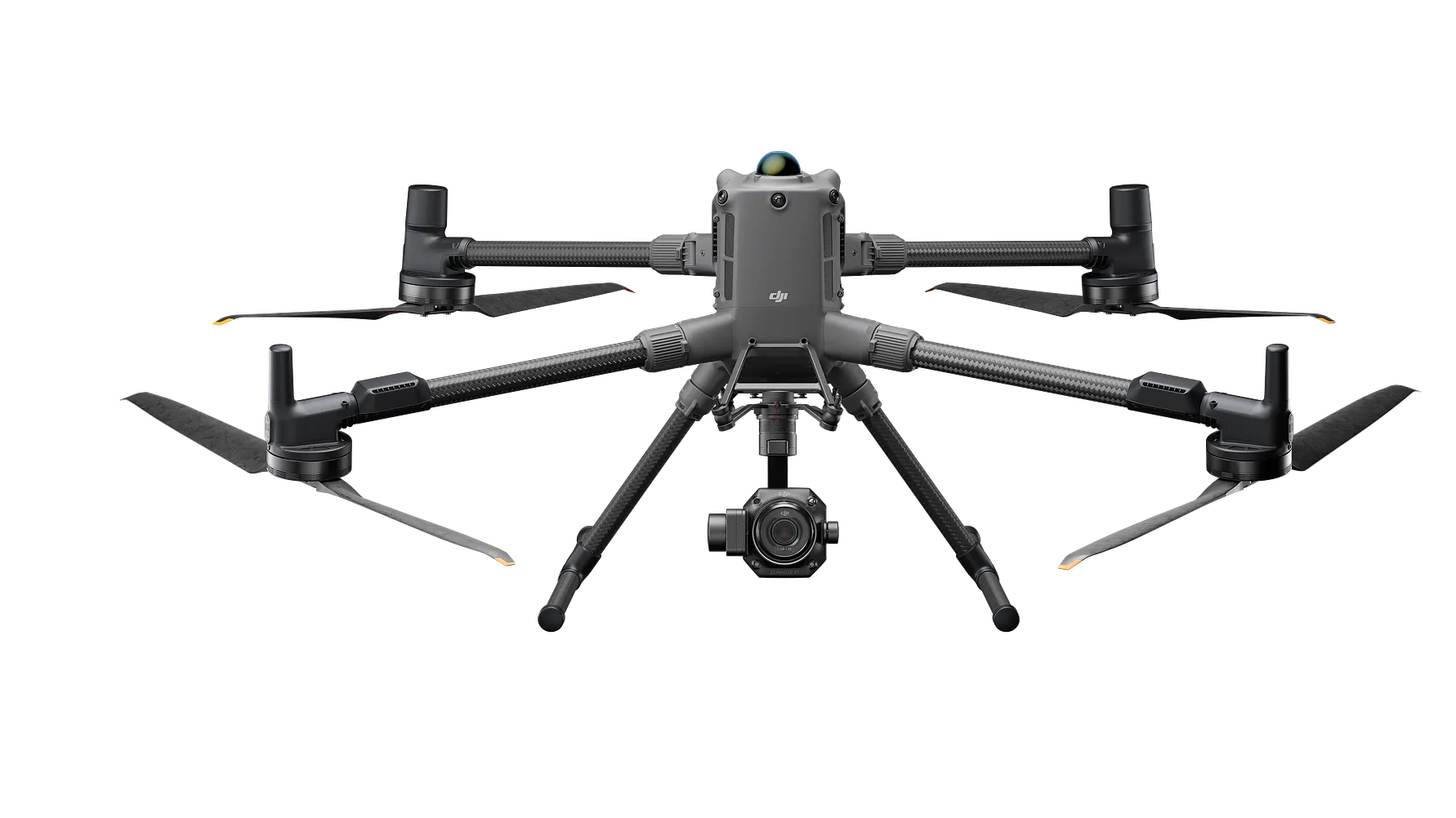
Turn overlapping aerial photographs into a detailed view of your building, site or landscape. Our Matrice 400 and Zenmuse P1 capture imagery for 3D models, point clouds and orthomosaic maps, with D-RTK 3 positioning support planned around your project.
Commercial solar planning & maintenance
A roof or site overview helps a solar team discuss array zones, obstructions, rooflights and access before agreeing a layout or maintenance visit. An agreed orthomosaic or 3D model gives everyone a shared visual reference.
For existing systems, relate inspection image references to named roof areas or verified array zones. For proposed installations, specify the measurements and accuracy the designer needs before capture; structural suitability and electrical design require separate assessments.
Renew-Able: what to check before putting solar on an older commercial roof
Discuss a solar mapping brief →
Compare commercial solar visual, thermal and mapping options →
Our thermal 3D roof video demonstrates visual context. It is not presented as an orthomosaic or proof of measured survey accuracy.
From photographs to a digital site
A roof has slopes, edges, chimneys and surrounding obstacles that a single overhead picture cannot fully describe. Photogrammetry combines photographs taken from overlapping positions to reconstruct the visible surfaces.
For a development site, that can provide an up-to-date overhead map. For a building, it can produce a textured model that your team can rotate and inspect. We agree the purpose and output before flying.
What you get
Your quotation identifies the outputs included, coverage, file formats and any accuracy checks required.
| Output | What it shows | How you can use it |
|---|---|---|
| Textured 3D model | A digital reconstruction of visible building or site surfaces. | Explore viewpoints, explain a proposal and discuss roof or site layouts. |
| Orthomosaic map | Overlapping images combined into a geometrically corrected overhead image. | Review the site layout, record visible features and compare survey dates. |
| Photogrammetric point cloud | A set of 3D points calculated from the photographs. | Provide spatial data for an agreed CAD, GIS or modelling workflow. |
| Surface model or contours | Height information derived from the captured surfaces, where suitable. | Support agreed terrain or site-planning questions, with vegetation and coverage limits explained. |
Tell us your software and required format before booking. A visual model is not automatically a measured survey or a finished CAD/BIM design.
P1 + D-RTK 3
The P1 is a 45-megapixel full-frame camera designed for photogrammetry. Its mechanical shutter and oblique capture options support the collection of overlapping images, including views of building sides.
The D-RTK 3 provides positioning corrections for the aircraft when configured as a base station. This helps place the captured data in a consistent spatial reference.
Final map accuracy also depends on the reference coordinates, flight plan, image quality, processing and independent checks. We agree tolerances, coordinate system, ground control and check points where the project requires them.
Manufacturer references: Zenmuse P1 and D-RTK 3.
DJI’s P1 Smart Oblique tutorial shows the capture technique. It uses an earlier aircraft platform; our P1 flies on the Matrice 400. Open the DJI demonstration →
Your project, step by step
Send the address or site boundary, the questions you need answered, your software and any measurement requirements.
We plan image overlap, viewing angles, positioning and access around the site. Buildings, vegetation and reflective surfaces affect coverage.
The photographs are aligned and processed into the commissioned map or model. We review coverage and any agreed accuracy evidence.
We provide the selected outputs with their survey date, scope and relevant limitations, so the next user understands what the data represents.
It can give a designer useful roof and obstruction context. If dimensions are needed for design or setting out, the required accuracy must be specified and checked. Roof structure, electrical design and installation suitability still need the appropriate assessments.
No. These point clouds are calculated from photographs. LiDAR uses laser measurements. We specify the capture method and do not describe a P1 photogrammetry job as a LiDAR survey.
Photogrammetry reconstructs surfaces visible in the images. Dense vegetation can hide the ground, so a surface model may include the canopy rather than bare earth. We discuss suitable alternatives if ground levels are essential.
Send the site boundary, intended use and the files your team needs.
Costs, turnaround, output options & example report contents →
All drone services · Our DJI fleet · Discuss your project
Based around Edinburgh and East Lothian, with enquiries welcome from across Scotland. Call 0131 210 0405 or email hello@openskyphotography.co.uk.